See Watershed Condition Statements from the Rideau Valley Conservation Authority and the South Nation Conservation Authority below.
Rideau Valley Conservation Authority FLOOD WARNING
April 6, 2023 – A combined Flood Warning and Flood Watch is in effect for the Rideau Valley following a significant rain/freezing rain event on April 5, 2023. Flood conditions are present in many low-lying areas adjacent to several rivers, creeks and ditches. Additional areas have the potential to flood over the next few days, especially because of snow remaining within the City of Ottawa and the Tay River watershed.
The short-term weather forecast indicates no precipitation for next few days. Daytime temperatures will generally be above zero and night-time temperatures will be below zero for next few days. Temperatures are expected to stay above zero moving into next week.
Based on the above, water levels and flows are expected to increase or remain elevated in all waterways in the Rideau Valley Watershed throughout next week. Some specific areas of concern are highlighted below:
A FLOOD WARNING is being issued for the following areas:
- Properties around Bob’s Lake, Christie Lake and Tay River in the upper Rideau Valley Watershed. The water levels are expected to exceed full supply levels over the next 48 hours and may result in flooding for low-lying areas. Parks Canada staff are closely monitoring the water levels in Bobs Lake and Christie Lake, and operations at the Bolingbroke Dam will take place as required, to balance the levels in Bobs Lake and Christie Lake.
Flooding impacts are occurring and expected to continue in the following areas:
1. Properties around the smaller creeks and streams in the lower Rideau Valley Watershed, including the low-lying roads and waterfront properties adjacent to Stevens Creek (near North Gower), and any connected creeks or ditches.
2. The Rideau River near Becketts Landing and Kemptville Creek, particularly the areas around Hilly Lane, Rideau Glen Lane, Golf Course Lane, Barts Lane and Cedar Beach Lane.
A FLOOD WATCH is being issued for the following areas:
- Properties around Wolfe Lake and Big Rideau Lake
- Properties along the Rideau River from Smiths Falls through Burritts Rapids
- The Rideau River near Becketts Landing and Kemptville Creek, particularly the areas around Eligh Lane, Fennel Lane, Lannin Lane, Sheppard Lane, McGahey Lane, Sheilas Way and Harris Road
- Low-lying properties (close to Rideau River) on Rideau River Lane and the community of Rideau Gardens.
With the elevated conditions, potential exists for further impacts if significant additional rain or rapid snow melt were to occur before the water levels and flows begin to recede.
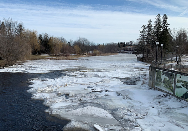
Due to the presence of ice cover on the lakes mentioned above and the anticipated water level increases, there is a concern for shoreline damage due to large pieces of ice becoming mobile.
With changing water levels expected over the coming days, ice cover on lakes, ditches, local streams and rivers will continue to be unstable. Extreme caution should be exercised when near local waterbodies. Parents should inform their children of the risks and provide appropriate supervision.
As temperatures continue to rise, the potential for ice jams remains high in some local streams and rivers, as flows could quickly increase before the ice can melt. Residents are advised to monitor their local river closely for signs of ice jams as spring progresses. RVCA staff will be monitoring conditions but we always welcome unique observations from watershed residents.
Flooding along roadways is also a concern due to current snow/ice buildup on roadside ditches.
Residents in flood prone or low-lying areas, historically susceptible to flooding, should take the necessary precautions to protect their property, such as:
- Ensuring sump pump is clear, in good working condition and has a backwater valve
- Ensuring easy access to a portable backup generator and pump
- Ensuring downspouts are clear and the outlet is at least 3 metres from the dwelling
- Securing items that might float away as flows increase
- Removing valuable items from basements or lower floors that could be subject to flooding
- Keeping emergency phone numbers handy
- Familiarizing yourself with your municipality’s Emergency Preparedness Plan
This watershed conditions statement is in effect until Friday, April 14, 2023 and may be updated at that time unless the forecast or conditions change.
For more information:
RVCA: Brian Stratton, RVCA Manager Engineering Services, 613-692-6804, 1-800-267-3504 ext. 1141
See Watershed Conditions here.
Please see Ontario's Flooding Emergency Preparedness site here.